Libros importados con hasta 50% OFF + Envío Gratis a todo USA  Ver más

menú

0
  • argentina
  • chile
  • colombia
  • españa
  • méxico
  • perú
  • estados unidos
  • internacional
portada The use of geoinfomation technology in space-time monitoring (en Inglés)
Formato
Libro Físico
Idioma
Inglés
N° páginas
64
Encuadernación
Tapa Blanda
Dimensiones
22.9 x 15.2 x 0.4 cm
Peso
0.10 kg.
ISBN13
9786204028019
Categorías

The use of geoinfomation technology in space-time monitoring (en Inglés)

Dyego Lins Da Silva (Autor) · Maria Das Neves (Autor) · Marcia Cristina de Souza Matos (Autor) · Our Knowledge Publishing · Tapa Blanda

The use of geoinfomation technology in space-time monitoring (en Inglés) - Lins Da Silva, Dyego ; Neves, Maria Das ; Souza Matos, Marcia Cristina de

Libro Físico

$ 36.28

$ 43.09

Ahorras: $ 6.81

16% descuento
  • Estado: Nuevo
Se enviará desde nuestra bodega entre el Lunes 03 de Junio y el Martes 04 de Junio.
Lo recibirás en cualquier lugar de Estados Unidos entre 1 y 3 días hábiles luego del envío.

Reseña del libro "The use of geoinfomation technology in space-time monitoring (en Inglés)"

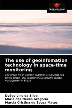
This book aimed to raise, measure, analyze and calculate the forecast of Future Scenarios, on the space-time monitoring of the urban network and the coastline of the beach Enseada dos Corais - Cabo de Santo Agostinho - Pernambuco, in the last forty-one (41) years; using the technologies of Geoinfomation (GPS, UAV, Geoprocessing, GIS among others), subsidizing the sustainable coastal management of this coast. For this, the methodology used comprises the use of current and past cartographic documents, such as: photographs of areas from 1974, 1981, 1997; and, field survey of the coastlines 2010 and 2015, using geodesic equipment and GPS/GNSS receivers, added to the survey and acquisition of aerial images by Unmanned Aerial Vehicle (UAV). The reference year for the calculation of the lines was 1974 and the other years. The results in the average rates of displacement of the coast line were 1.09 m/year (1974-1981), 0.31 m/year (1974-1997), 0.47 m/year (1974-2010), -1.06 m/year (1974-2015); presenting accelerated erosion from 2010. The research provides scientific data to support Coastal Management Plans.

Opiniones del libro

Ver más opiniones de clientes
  • 0% (0)
  • 0% (0)
  • 0% (0)
  • 0% (0)
  • 0% (0)

Preguntas frecuentes sobre el libro

Todos los libros de nuestro catálogo son Originales.
El libro está escrito en Inglés.
La encuadernación de esta edición es Tapa Blanda.

Preguntas y respuestas sobre el libro

¿Tienes una pregunta sobre el libro? Inicia sesión para poder agregar tu propia pregunta.

Opiniones sobre Buscalibre

Ver más opiniones de clientes