Libros importados con hasta 50% OFF + Envío Gratis a todo USA  Ver más

menú

0
  • argentina
  • chile
  • colombia
  • españa
  • méxico
  • perú
  • estados unidos
  • internacional
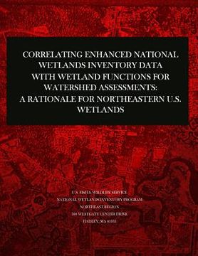
portada Correlating Enhanced National Wetlands Inventory Data with Wetland Functions for Watershed Assessments: A Rationale for Northeastern U.S. Wetlands (en Inglés)
Formato
Libro Físico
Idioma
Inglés
N° páginas
32
Encuadernación
Tapa Blanda
Dimensiones
28.0 x 21.6 x 0.2 cm
Peso
0.10 kg.
ISBN13
9781507771761
Categorías

Correlating Enhanced National Wetlands Inventory Data with Wetland Functions for Watershed Assessments: A Rationale for Northeastern U.S. Wetlands (en Inglés)

U S Fish & Wildlife Service (Autor) · Createspace Independent Publishing Platform · Tapa Blanda

Correlating Enhanced National Wetlands Inventory Data with Wetland Functions for Watershed Assessments: A Rationale for Northeastern U.S. Wetlands (en Inglés) - U S Fish & Wildlife Service

Libro Físico

$ 10.20

$ 12.75

Ahorras: $ 2.55

20% descuento
  • Estado: Nuevo
Se enviará desde nuestra bodega entre el Lunes 17 de Junio y el Martes 18 de Junio.
Lo recibirás en cualquier lugar de Estados Unidos entre 1 y 3 días hábiles luego del envío.

Reseña del libro "Correlating Enhanced National Wetlands Inventory Data with Wetland Functions for Watershed Assessments: A Rationale for Northeastern U.S. Wetlands (en Inglés)"

The U.S. Fish and Wildlife Service has been conducting the National Wetlands Inventory for over 25 years. The NWI Program has produced wetland maps for 91% (78% final) of the lower 48 states, all of Hawaii, and 35% of Alaska. Wetlands are classified according to the Service's official wetland classification system (Cowardin et al. 1979). This classification describes wetlands by ecological system (Marine, Estuarine, Lacustrine, Riverine, and Palustrine), by subsystem (e.g., water depth, exposure to tides), class (vegetative life form or substrate type), subclass, water regimes (hydrology), water chemistry (pH and salinity), and special modifiers (e.g., alterations by humans). The maps have been converted to digital data for 47% of the lower 48 states and 18% of Alaska. The availability of digital data and geographic information system (GIS) technology make it possible to use NWI data for various geospatial analyses.

Opiniones del libro

Ver más opiniones de clientes
  • 0% (0)
  • 0% (0)
  • 0% (0)
  • 0% (0)
  • 0% (0)

Preguntas frecuentes sobre el libro

Todos los libros de nuestro catálogo son Originales.
El libro está escrito en Inglés.
La encuadernación de esta edición es Tapa Blanda.

Preguntas y respuestas sobre el libro

¿Tienes una pregunta sobre el libro? Inicia sesión para poder agregar tu propia pregunta.

Opiniones sobre Buscalibre

Ver más opiniones de clientes